RunRace USA › Ohio › Cleveland › Cleveland Marathon
The complete guide
Cleveland Marathon 2027
Sunday, May 16, 2027 · 7:00 a.m. · St. Clair Avenue at West Mall Drive, alongside Mall B
The race in 60 seconds
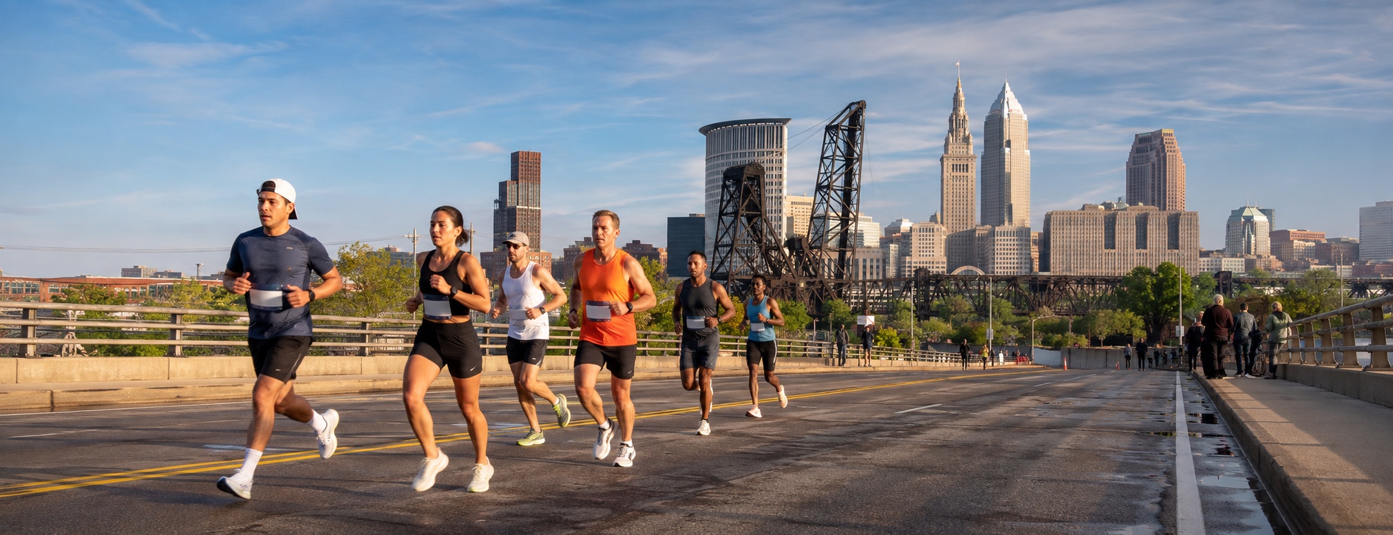
Cleveland has been running this race since 1978, which puts it among the fifty oldest marathons in America. It is a lakefront city marathon that starts and finishes on the same downtown block, runs through six distinct neighbourhoods, crosses the Cuyahoga twice, and spends four miles on the shore of a Great Lake. The modeled trace fits inside roughly 100 feet of elevation. What it does with those feet is the whole story, and it is below.
Fly the course
Run all four race-weekend courses through a live 3D Cleveland. Choose the marathon, half, 10K or 5K, then switch between a cinematic chase, runner-eye and aerial view. The roads follow the organizer's current published course files; the skyline, lakefront, river bridges, parks and elevation are drawn around that route in real time.
Route statusLatest official published course set: 2026. The 2027 weekend is open, but no replacement 2027 route geometry has been posted yet. Checked September 4, 2026.
The four route lines come from the organizer's current published files. Public-domain USGS and USDA aerial photography plus USGS 3DEP elevation are baked into RunRace USA, so the flyover uses no paid map API or third-party runtime requests. Buildings, roads and shoreline use OpenStreetMap, ODbL; signature Cleveland landmarks are calibrated by hand. Map services and data available from U.S. Geological Survey, National Geospatial Program. This is photographic terrain with modeled architecture, not photogrammetry. Bridge approaches, elevations and facade details are approximations; the organizer's published route remains the reference. Cleveland landmarks, neighborhood buildings and street objects include original Blender-authored models. Street names follow mapped intersections. Fine architectural details, sign supports and unmapped street furniture are interpreted, not surveyed; this is not photogrammetry. St. Theodosius shows a simplified restoration-state exterior from March–July 2026 sources; roof staging may differ.
The elevation profile
The modeled trace lives inside roughly 100 feet of elevation, and about 716 feet of total climb is modest for a marathon. Both of those numbers hide the same thing: the climbing is not spread out. Two hills carry most of it.
- Scranton Hill, mile 6.9 to 7.8: 100 feet up, roughly 3.4% at its steepest, from mile 7.2 to 7.6.
- The Shoreway climb, mile 23.9 to 24.6: 80 feet up, roughly 3% for the middle half mile.
This Half marathon profile covers 13.1 miles, ranges from roughly 573 to 688 feet, and contains about 374 feet of modeled climb.
- Scranton Hill, mile 6.9 to 7.8: 100 feet up.
This 10K profile covers 6.2 miles, ranges from roughly 594 to 664 feet, and contains about 155 feet of modeled climb.
This 5K profile covers 3.1 miles, ranges from roughly 594 to 658 feet, and contains about 85 feet of modeled climb.
The course, on a map
Gold is the marathon course: downtown, the lakefront, the Flats, Tremont, Ohio City, Edgewater and Lakewood, then home on the Shoreway.
Gold is the half marathon course. It shares the full route through downtown, the Flats, Tremont and Ohio City, then splits at West Huron for the St. Clair finish.
Gold is Saturday's 10K: North Coast Harbor first, then a longer downtown loop through Euclid, Cleveland State and Public Square before returning to Mall B.
Gold is Saturday's 5K: North Coast Harbor, the Lakeside turnaround, Public Square and the return to Mall B.
What race morning usually feels like
Across the ten Mays from 2016 to 2025, the nine days around this race weekend averaged a low of 52°F and a high of 66°F at the start line. A 7 a.m. gun usually means mid 50s, which is close to ideal. The spread is the honest part: the same nine-day window has produced days as warm as 85°F and mornings as cold as 35°F, and about 32% of those days saw measurable rain.
The variable that actually decides your day is wind off the lake. Three parts of this course have nothing between you and open water: the Erieside stretch at mile 4.6, Edgewater and Lake Avenue from 16 to 22, and the Shoreway from 23 to 25. Average peak wind across that window is 14 mph, but it has hit 23. Check the forecast direction, not just the speed: a north wind turns miles 17 through 22 into a different race.
Pacing it
Even splits work on this course better than most, because the two hills roughly cancel: about 100 feet up at mile 7, and the downhill from mile 24.6 to the line gives most of the mile-24 climb back. The mistake here is not the hills. It is Euclid Avenue in mile 2, which is wide, gently downhill, and full of people who have not yet remembered they are running a marathon.
| Finish | Even pace | Halfway |
|---|---|---|
| Sub 3:00 | 6:52 /mi | 1:30 |
| 3:05 (BQ, men 18-34) | 7:03 /mi | 1:32 |
| 3:20 | 7:38 /mi | 1:40 |
| 3:35 (BQ, women 18-34) | 8:12 /mi | 1:47 |
| 4:00 | 9:09 /mi | 2:00 |
| 4:30 | 10:18 /mi | 2:15 |
| 5:00 | 11:27 /mi | 2:30 |
| Published course limit, 7:00 | 16:01 /mi | 3:30 |
The rest of the guide
The course
The 3D flythrough at full size, the elevation profile, the organizer's official turn sheet and a note on every mile.
Where to stay
20 hotels inside a 26 minute walk of the start, with the walk time for each.
Expo and logistics
Expo hours, the weekend schedule, road closures, parking, and the train that ignores all of it.
Spectators
Three worked plans, and every official cheer zone with its mile marker.
The weekend
The city the course runs through, tied to the mile you pass it.
Other Cleveland races
Everything else on the calendar in this city.
Common questions
When is the 2027 Cleveland Marathon?
Race weekend is May 15 to 16, 2027. The marathon and half marathon start at 7:00 a.m. on Sunday, May 16, at St. Clair Avenue and West Mall Drive downtown. The 5K and 10K run Saturday at 7:30 a.m. from the same start line.
Is the Cleveland Marathon a Boston qualifier?
Yes. The course is USATF certified and measured every year with a calibrated bike, and Cleveland is a recognised Boston qualifying race. The organizer warns that consumer GPS elevation is not authoritative, but the modeled trace suggests about 550 feet of total climb on a mostly flat course rather than a downhill-assisted one.
Is the Cleveland Marathon course flat?
Mostly, with two exceptions that matter. The whole course spans only about 100 modeled feet of elevation. The clearest climbs are roughly 100 feet on Scranton Hill between mile 6.9 and mile 7.8, and roughly 80 feet off the Shoreway between mile 23.9 and mile 24.6. Everything else is rolling at worst.
What is the time limit?
The open-course limit is seven hours, which works out to a 16:01 per mile road-support pace. The organizer says the finish remains staffed after seven hours, but runners behind that pace may need to use sidewalks and obey normal traffic controls.
Where is the expo and can I get my bib on race morning?
The expo is at the Huntington Convention Center, Hall A, 300 Lakeside Avenue East, on Friday and Saturday. The published schedule lists no race-morning pickup, so plan to land Friday or early Saturday and collect your bib at the expo.
How early do I need to be downtown?
Before 6 a.m. on Sunday. Road closures go up well before the 7 a.m. start and most of the streets you would drive in on are course.
Where should I stay?
Downtown, inside the half mile around Public Square and the convention center, if you can. More than a dozen hotels sit within a ten minute walk of the start line, the expo is under Mall B, and the finish line is on the same street. Full list with walking times is on the where to stay page.
What is the weather usually like?
Over the ten Mays from 2016 to 2025, the days around race weekend averaged a 52F low and a 66F high, with rain on about a third of them. A 7 a.m. start typically means mid-50s at the gun. The real variable is wind off the lake on the exposed sections at miles 4.6, 17 and 23.
How big is the field?
More than 13,000 runners took part across all events on the 2026 weekend, the half marathon much the largest of them. What matters on course is that most of the runners around you at mile 13 leave at the West Huron split before the Detroit-Superior Bridge, and the road gets abruptly quiet when the marathon turns toward the bridge.
Which is better, the full or the half?
The half gets the best of the course: downtown, the lakefront, the Flats, Scranton Hill, Tremont and Ohio City, all inside 13.1 miles, before splitting off at West Huron for the same St. Clair finish. The full adds the Detroit-Superior Bridge, the Lake Avenue out-and-back and the Shoreway: a longer, more exposed tour with the bridge and lakefront as its defining tests.
Register for the 2027 Cleveland Marathon →on Race Roster
Course geometry provenance is stated beside the player; elevation profiles always use the same route loaded there. City geometry is OpenStreetMap, ODbL. Aerial imagery is from USGS and USDA; other images carry their own source credits. Weather figures use Open-Meteo reanalysis for May 12-20 across 2016-2025 at the start line. Schedule, prices and expo hours were checked in September 2026 and are the fields most likely to move: confirm them on www.clevelandmarathon.com before you book anything. Spot an error? Tell us and we'll fix it fast.